February 17, 2016
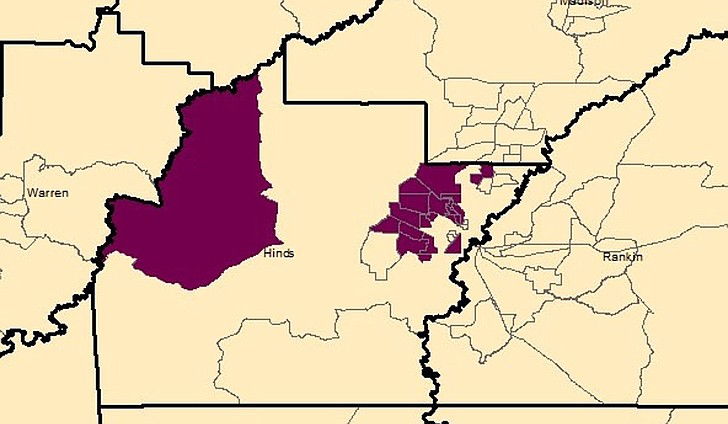
Food deserts border the west side of the Interstate 220 corridor and the northwest corner of Hinds County. (Note: this map isolates Hinds County and does not show food deserts in surrounding counties.) Visit the USDA’s website to see a full map of Mississippi’s food deserts. Photo courtesy Hope Policy Institute
Comments
Use the comment form below to begin a discussion about this content.
Sign in to comment
Or login with:
OpenID