Wednesday, August 18, 2010
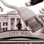
Jackson doesn't have a reputation for being a particularly tech-savvy place, but this fall, city government will begin changing that image. City hall is poised to adopt two new technologies that will--hopefully--improve the efficiency and responsiveness of the city's police, fire and public works departments, among others.
The first, 311, is a citizen complaint system already widely used across the country that system will allow residents to report potholes, open fire hydrants and other nuisances by calling a hotline or visiting a city website. The 311 system automatically logs service requests and transmits work orders to the relevant city department. It also pinpoints the location of requests using a mapping technology known as geographic information systems, or GIS.
Using GIS, the system could create a map of every fire hydrant in the city. Citizens and city workers could use the map to discern patterns in water issues that might be difficult to see otherwise.
The second, JACKSTAT, is modeled after statistical accountability systems in Baltimore, New York City and the Jackson Police Department's own Comstat process. JPD collects data on the relevant activities of its various divisions--arrests, crimes reported, tickets written and miles driven, for example--and reviews them at a weekly meeting. JACKSTAT would expand that regular review of data to the city's other departments, giving Mayor Harvey Johnson Jr. and his staff objective data that can reveal inefficiencies in city operations.
City spokesman Chris Mims, who is leading the city's adoption of the new technologies, says that JACKSTAT will be able to produce reports showing how long it takes the city to address complaints and issues. With that information, city officials can set clear goals for improving services, Mims says. The Public Works Department could aim to reduce the time it takes to repair a water main from four days to three, for example.
Mims says that he hopes to bring a contract for the 311 software to the Jackson City Council "in the next several weeks," but it will take longer for the city to start using all the capabilities of JACKSTAT and 311.
"It's going to be a shift in culture," he said. "We're going to have get people trained and acclimated to it, but I think that probably, given a year or so after implementation, we'll be able to generate all sorts of reports."
While JACKSTAT and 311 can make Jackson's government more efficient, similar technologies can also help make it more transparent. Jackson's 311 system should ultimately allow citizens to track their own service requests, Mims says. A Web startup called SeeClickFix already allows citizens to tag "issues" in their hometown using Google Maps, but it relies on those citizen users to update the issues with any progress. Jackson's system would show residents what steps city workers took to address their complaints.
Public works are just one area in which new technology and data-collection can promote greater transparency, though. If city leaders make more of their electronic data--culled from 311 and JACKSTAT--available to the public, planners, media organizations, engineers and civic-minded software developers can transform it into useful applications that city government does not have the time, interest or ability to create.
After New York City began publishing scheduling data for its transit system earlier this year, third-party software developers were able to put together applications that locate buses and trains in real-time.
Computer-savvy citizens in San Francisco worked with the city's Department of Public Works to develop a smart-phone application that catalogs the almost 65,000 trees in the city. Users can walk up to a tree and learn its species name and those of its neighbors.
While San Francisco and New York City are renowned hotbeds of technology and innovation, groups in Jackson are just as eager to use the wealth of municipal data that JACKSTAT and 311 would amass.
The Jackson Community Design Center is currently seeking grant funding for research that would harness some of the same information as the city initiatives. The project, City4D, would use GIS to compile census data with zoning and planning information to create a digital model of Jackson, accessible to anyone with a computer or smart phone. Planners and developers could use the model to study how potential building projects might affect the city. And, like 311, the model would be interactive, giving citizen users a chance to view and offer input on planning decisions before they're made.
Comments
Use the comment form below to begin a discussion about this content.
Sign in to comment
Or login with:
OpenID